
Discover Kromerowo
Accommodation in Kromerowo
A red cycling route runs through Kromerowo; the village is also located south of the southern tip of Lake Dadaj. For travellers who would like to combine cycling with local history, these are two specific points of reference. Other highlights include a founding charter from the second half of the 16th century and a wayside chapel west of the village on National Road 16. You can start by considering the cycling route and your interest in the village’s history when deciding whether Kromerowo is right for your trip.
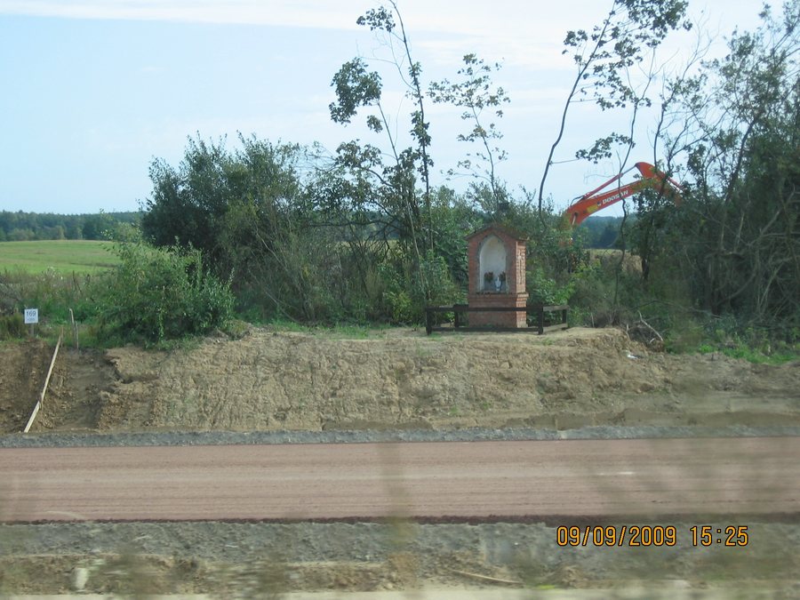
Local History and Wayside Chapel
In the second half of the 16th century, Kromerowo received its founding charter from Bishop Marcin Kromer. This provides a specific historical point of reference for the village. For travellers who also want to explore smaller towns and their history while visiting Poland, this adds to the village’s geographical setting south of Lake Dadaj.
The wayside chapel on National Road 16, west of Kromerowo, stands on a stone base and is built of brick. It has a rectangular floor plan. A large pointed-arch niche dominates the front, while narrow, tall niches are set into the sides. The gabled roof is covered with ceramic tiles. The chapel also has an iron cross and a weather vane bearing the construction date. The structure thus brings together a range of architectural features: its base and masonry, the shape of the niches, and its roof and finial. These details give visitors interested in culture specific features to look for when exploring the wayside chapel.
The wayside chapel is listed as an immovable monument under entry A-4526, dated 3 June 2009. The listing and the architectural features described above complement the historical founding charter with a distinct architectural connection to the village’s history.
Cycling Route and Getting Around
The red cycling route through Kromerowo is 60 km long. This makes cycling a clearly defined focus for planning your trip. If you are considering Kromerowo as a destination, you can compare the route with your interest in a longer cycling route. The 60 km figure describes the route as a whole; it does not indicate how much of it runs within the village. The fact that the route passes through the village remains the key consideration when deciding whether Kromerowo is a good fit for a cycling trip.
Another dated feature of the transport area is the so-called green wildlife bridge: it was built in Kromerowo over National Road 16 in 2010. Alongside the 16th-century founding charter, this provides another subject for exploring local history: a structure dating from 2010, as well as a wayside chapel by the national road.
Two municipal bus lines also pass through or serve Kromerowo. Line B1 runs from Wipsowo via Ramsówko, Ramsowo, Niedźwiedź, Kromerowo and Barczewo to Klebark Mały. Line B2 serves Kromerowo/Wies and runs from Leszno via Barczewo, Tumiany and Klimkowo. The different sequences of stops give you specific points of reference if bus connections are important when choosing your destination. B1 can be identified by its route via Wipsowo and Kromerowo; for B2, the key details are Leszno and its service to Kromerowo/Wies.
If you would like to consider another destination while planning your trip to Poland, you can also find Kaplityny here.
For the broader travel overview: Biedowo.

