
Discover Cerkiewnik
Accommodation in Cerkiewnik
Cerkiewnik can be explored from two different perspectives: the Church of Saint Catherine and Saint Anne, and several cycling and hiking routes that include the village in their itineraries. The church is a cultural landmark; the routes focus on modes of travel, distances in kilometres, and named places. This offers a concrete basis for comparing architecture and regional building styles on the one hand, and different route layouts on the other, when planning a trip. Cerkiewnik is both the start and finish of one cycling route and a stop along the way on other routes.
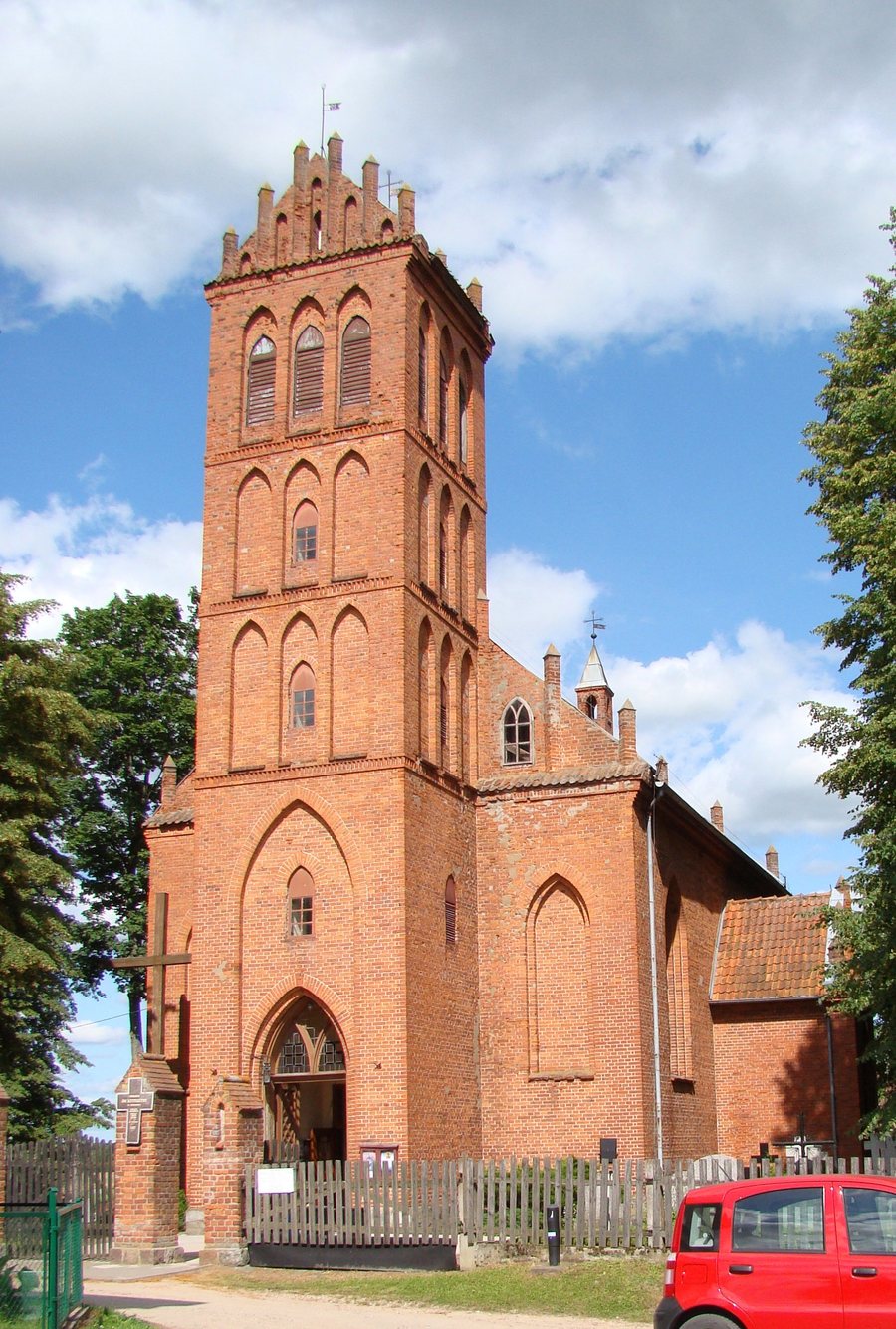
The Church of Saint Catherine and Saint Anne
The Church of Saint Catherine and Saint Anne stands on a hill in the centre of Cerkiewnik. It is a neo-Gothic, east-facing hall church built of red brick, with a rectangular floor plan. Its design draws on forms from the medieval architecture of Warmia. Each feature describes a different aspect of the building: the rectangular floor plan specifies its shape, “hall church” identifies its spatial type, and red brick describes its material. “East-facing” indicates its orientation, while the reference to Warmia’s medieval architectural forms places its design in a regional context. The church thus combines a distinctive architectural form with a clearly stated connection to Warmia’s architectural history. For those interested in culture, its appeal lies in the interplay between its design and its regional context.
Cycling routes starting in and passing through Cerkiewnik
The cycling routes differ in both length and starting point. The 17 km loop starts in Cerkiewnik, passes through Barkweda, Bukwałd and Różynka, and returns to Cerkiewnik. The second route covers 20 km: it starts in Dobre Miasto, passes through Głotowo, Swobodna, Lake Limajno and the Chmury Forest District before reaching Cerkiewnik, then returns to Dobre Miasto via Swobodna and Knopin. The three-kilometre difference is only one aspect of the comparison. Cerkiewnik is the start and finish of the 17 km loop, while Dobre Miasto takes that role on the 20 km route. The sequence of places therefore shows how differently the two loops are laid out, even without comparing their levels of difficulty. Check the current route before setting off.
Hiking routes: places and distances
For the hiking routes, it is worth looking at their total length and endpoints. The 42 km route runs from Olsztyn through Brąswałd, the bridge over the artificial channel of the Łyna, Barkweda and Bukwałd to Cerkiewnik; it then continues via Głotowo and Dobre Miasto to Smolajny. The 87 km Copernicus Hiking Trail runs from Olsztyn through Cerkiewnik, Dobre Miasto, Smolajny and Lidzbark Warmiński to Mingajny. Both itineraries include Cerkiewnik, Dobre Miasto and Smolajny, but their endpoints differ: the 42 km route ends in Smolajny, while the Copernicus Hiking Trail continues to Mingajny. At 87 km, the trail is a little more than twice as long as the 42 km route. The shared place names, different destinations and stated distances provide concrete points of comparison when planning a trip.
Discover more places to visit: Rybaki, Wojtkowizna, Ruś, Łomy, Jaroty, Jeziorany, Stawiguda, Butryny
For the main travel overview: Olsztyn.

